 |
| http://www.mapsofworld.com/egypt/maps/egypt-map.gif |
Location:
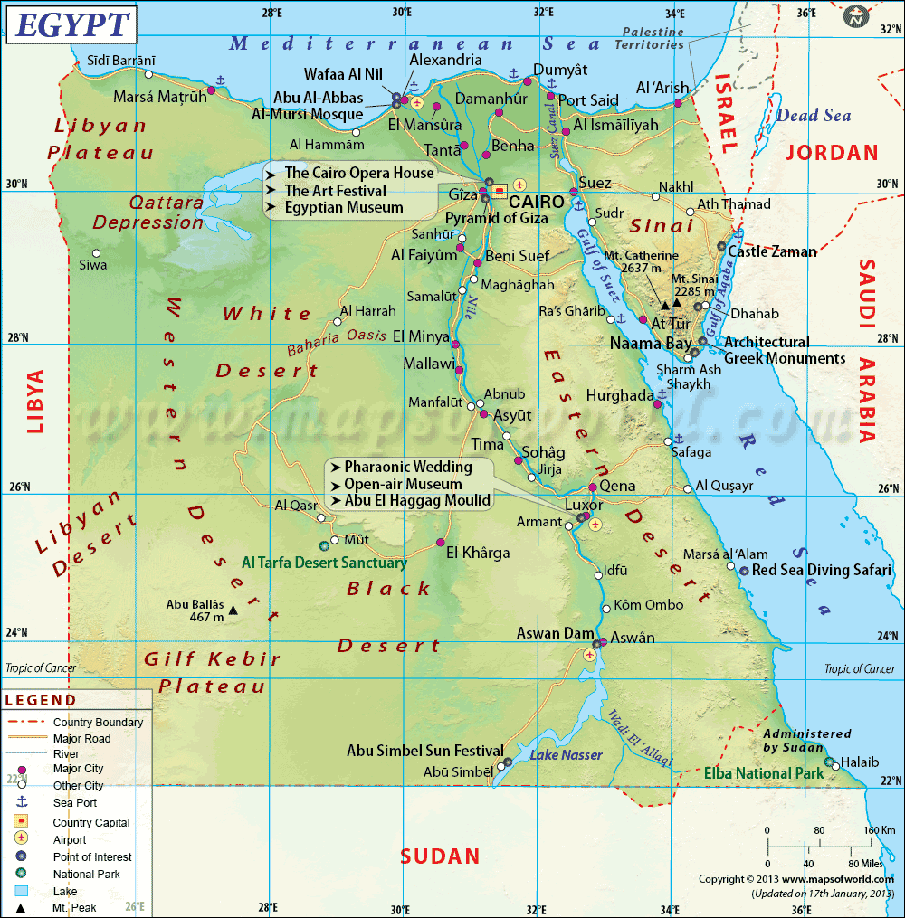
Egypt is located in Northern Africa, north of Sudan, east of Libya, west of Red Sea and south of the Mediterranean Sea.
Size:
Egypt covers an area of 1,001,450 sq km. Egypt's area is merely 12% of the United States. Mount Catherine is the highest point in Egypt, with a height of 8,625 feet. Oppositely, Qattara Depression is 439 feet below sea level.
Terrain:
Egypt has a vast variety of terrain, from seas to mountains to deserts. So where should we start off? Let's just jump right in. When you think of Egypt what is the first thing you think of? I personally think of pyramids and deserts. Egypt lies within the region of the Sahara Desert, however it is split into two different parts. The Western Desert is on the west of the Nile river. Since the Nile river is more on the right side of Egypt, the Western Desert covers most of the country. It covers 3/4 of the country with barren rock and sand. There are a few ridges and depressions, with very little vegetation. Since the desert on the west of the Nile is called the Western Desert, what do you think the desert of the east of the Nile is named? You may think it is called the Eastern Desert, but you are sadly mistaken. The desert on the east of the Nile is called the Arabian Desert. Unlike the Western Desert, the Arabian Desert is more elevated and rugged, with the Red Sea Highlands on the shore line.
Since we are talking about the Red Sea Highlands, it runs a long the coast of... you guessed it!! The Red Sea! This is the region of hills and rugged mountains.
Of course I cannot talk about Egypt and not mention the longest river in the world: The Nile River. The Nile river extends from south or Egypt all the way north. The Nile River used to be infamous for its floods, however now that is not a problem thanks to the Aswan High Dam. The Nile River has a never ending supply of fresh water, creating fertile farmland.
No comments:
Post a Comment